Australia’s ongoing bushfires are some of the worst on record. For months, the wildfires have wreaked havoc on the environment, blocking the sky, straining civil services and affecting about 5 million Australians.
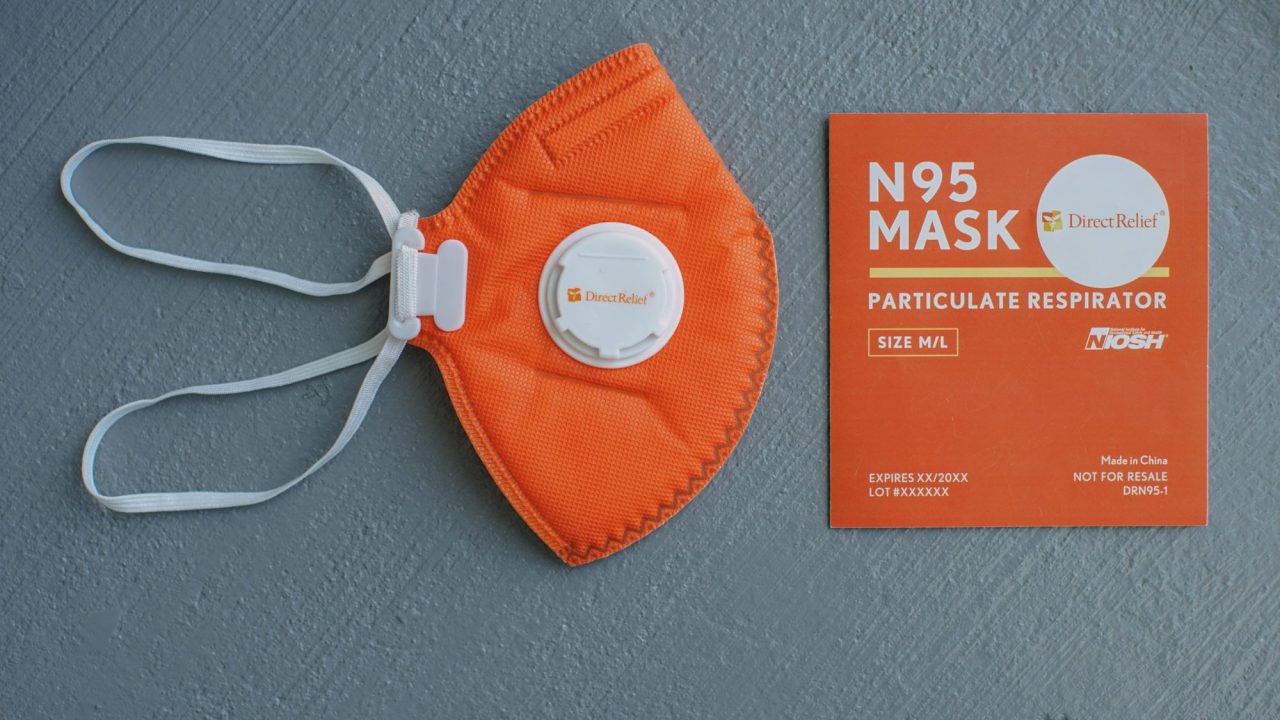
The air quality in affected areas has been deadly and damaging. Long-term effects of smoke inhalation can be debilitating. One of the most effective measures against wildfire smoke is a simple one: N95 masks.
N95 masks effectively filter smoke. The “95” refers to 95% – the amount of particles the mask is designed to filter that are larger than .3 microns across. (A micron is one-thousandth of a millimeter.)
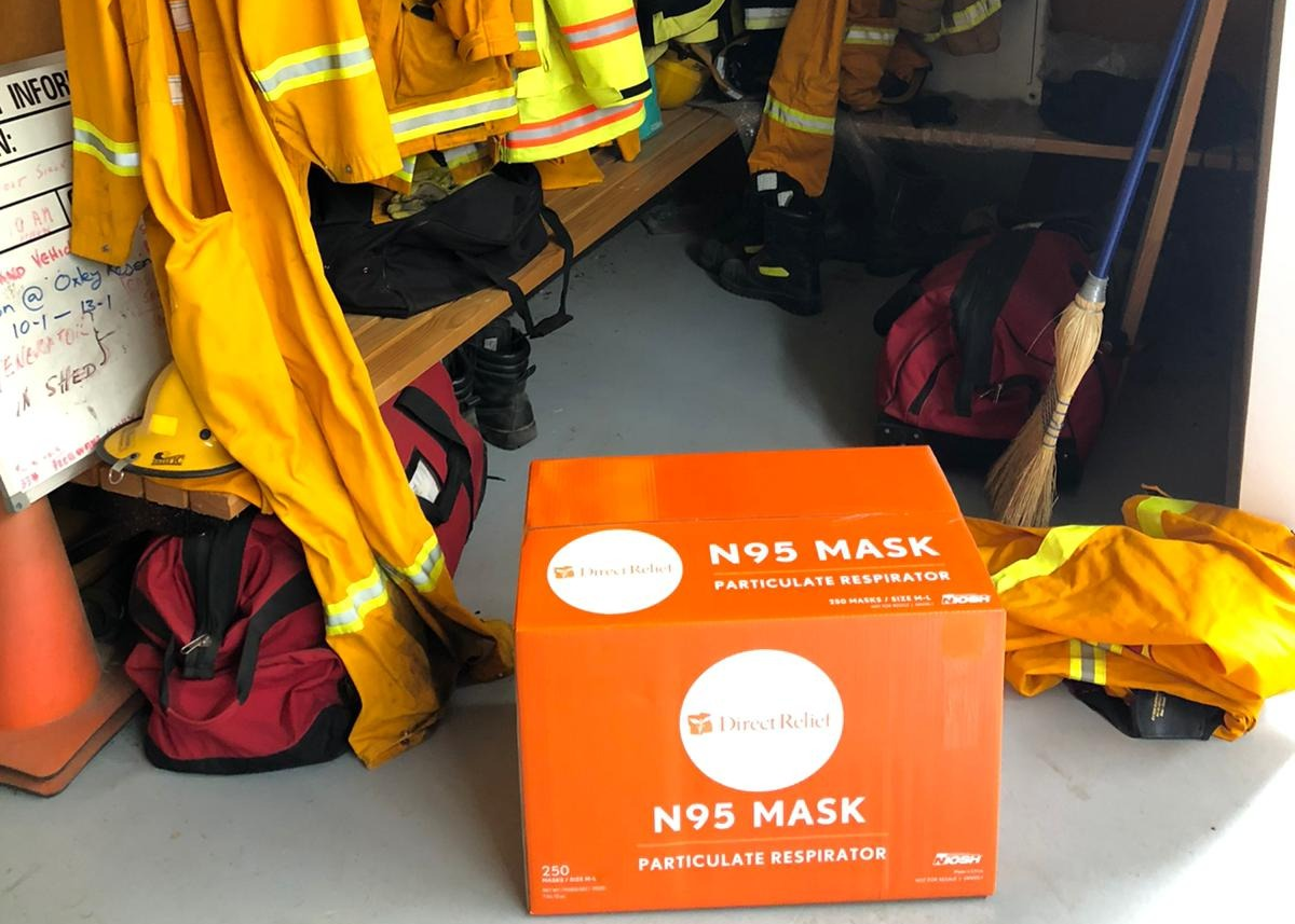
Direct Relief are experts in getting N95 masks into the right hands. Last year, the California-based humanitarian aid organization distributed 522,000 masks following the Kincade Fire in October and November of 2019.
Direct Relief doesn’t typically work in Australia. Yet Direct Relief has already shipped 317,500 masks to Australia, with another 112,500 on the way. The masks are headed to a wide range of local agencies for distribution.
So, how do you get half a million N95 masks to the right people from the other side of the world?
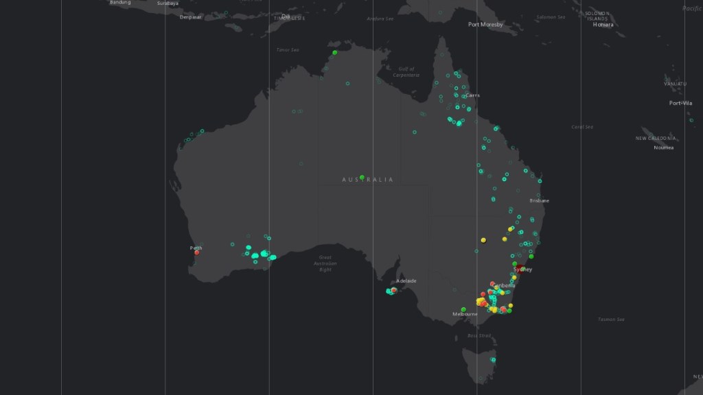
Factal talked to Andrew Schroeder, Direct Relief’s Vice President of Research and Analysis, about how he’s gotten up to speed on a continent in crisis – and how he created this map of Australian bushfire incidents in a weekend.
Factal: What have been the biggest challenges in responding to the crisis in Australia?
AS: We’ve actually been responding to a lot of wildfires around the world over the last couple of years. Australia is not really any different from the kind of response that we’ve done in other places. It’s just the scale has become really dramatic.
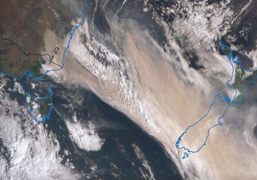
We’re in the process of sending over half a million N95 masks to a number of different partners that are distributed around mainly the areas of New South Wales and Victoria. That includes the governments that have been mounting larger efforts to protect the population from the results of the wildfire smoke. If you’ve seen the satellite imagery, the smoke plume is just shocking.
This is the context where the Factal data, in combination with other things, is just really valuable. In this case, you have an event that’s taking place over a huge area, and an area that we don’t normally have operations.
Trying to get oriented to what’s happening and where and the progression of this event has been challenging for us to do. We have to get booted up on it really quickly.
Factal: You’ve been using Factal’s feeds in Esri’s ArcGIS platform to visualize the latest news about the fires. What’s different about that compared to the maps within Factal?
AS: The thing that’s been really helpful about [the ArcGIS integration] is you can visualize it in ways that are a little different than in the Factal application itself. And we can connect it to other information, which I think is also really helpful.
Over the weekend [of January 4th], I basically built an application that pulls that data together and makes something that’s easier for our program officers and other partners to use.
Factal: That’s incredible! How have you used Factal before now?
AS: I think the first major event that we actually used Factal for was Hurricane Dorian. It was a similar kind of thing where when a disaster happens, the need to know what’s going on just really spikes very quickly.
The Bahamas was also an interesting case of a place where there’s not normally a reason for an organization like Direct Relief to work. So we don’t necessarily have a lot of pre-existing local knowledge, we had to build a whole bunch of partnerships. We had to orient ourselves to what’s happening on the ground really fast.
We’ve made it part of the routine. Whether it’s the Kincade Fire or response to Ebola in DRC, it’s part of the information loop now, like, “Go check Factal!”
Andrew Schroeder
It’s one thing for me to know it – it’s another thing for everyone in our organization to know this stuff. So I started connecting folks with access to Factal.
We’ve made it part of the routine. Whether it’s the Kincade Fire or response to Ebola in DRC, it’s part of the information loop now, like “go check Factal!” You’re going to find things that you just definitely aren’t finding in a lot of other places.
Factal: What would you be using in place of Factal if you didn’t have access to it?
AS: In terms of incident reporting, what we would do is read the news and try to correlate it as best we can with where the news is happening.
There really isn’t anything that I can think of which would compare to [Factal] being able to geolocate incidents from news reporting, and particularly from social media and from Twitter. I mean, we could use the Twitter API to kind of geolocate Twitter, but for us to actually peel through that and curate it in some way? That’s just something we don’t really have the person-power for.
There’s really nothing I’ve seen that does the same job of being able to do this very targeted, spatially specific, curated, multi-source incident reporting, and it’s just incredibly valuable, I think.
Factal: Thank you so much for the interview, Andrew – we know it’s always a busy time at Direct Relief.
AS: Thank you.
You can currently direct your donation specifically to Australian wildfires at Direct Relief’s website.
Tyler Adams is senior marketing manager at Factal, a breaking news verification platform relied on by many of the world’s largest organizations. He can’t imagine building an app in a weekend. Top photo: A shipment of N95 masks from Direct Relief at a local fire department in Moyhu, a small town in northeast Australia, via Direct Relief.