Written by Julie Case, Team Rubicon
Rockets were falling and still doctors and medics needed to reach the refugees. Between them and hundreds of thousands newly displaced persons was what could be, at any moment, a war zone. The volunteer army of medics and doctors would need to strategize; they’d need to plan their routes to the refugee encampments carefully. They’d need to know when they could travel, what routes were safest, and what makeshift medical centers were overwhelmed by the greatest number of internally displaced persons and needed the most help. And, they’d need to know where they could take their mobile medical clinic.
A combination of real-time reporting, data, maps, and ingenuity would make all of that possible in a way that would have been inconceivable during previous land wars in Europe.
Identifying real life threats in real time
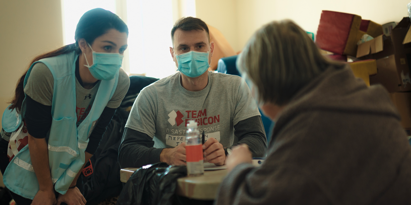
When Russia invaded Ukraine in the late winter of 2022, humanitarian and disaster response organization Team Rubicon deployed World Health Organization Type-I EMT certified teams to treat internally displaced persons and train local resources. In part, the veteran-led organization relied on old-fashion know-how to strategize—intel-gathering techniques accrued over decades of service in the military. Given that nearly 70% of Team Rubicon’s volunteers—or Greyshirts—are veterans, many had learned a thing or two about how to navigate war zones during their careers. That knowledge would be key, especially in navigating political landscapes.
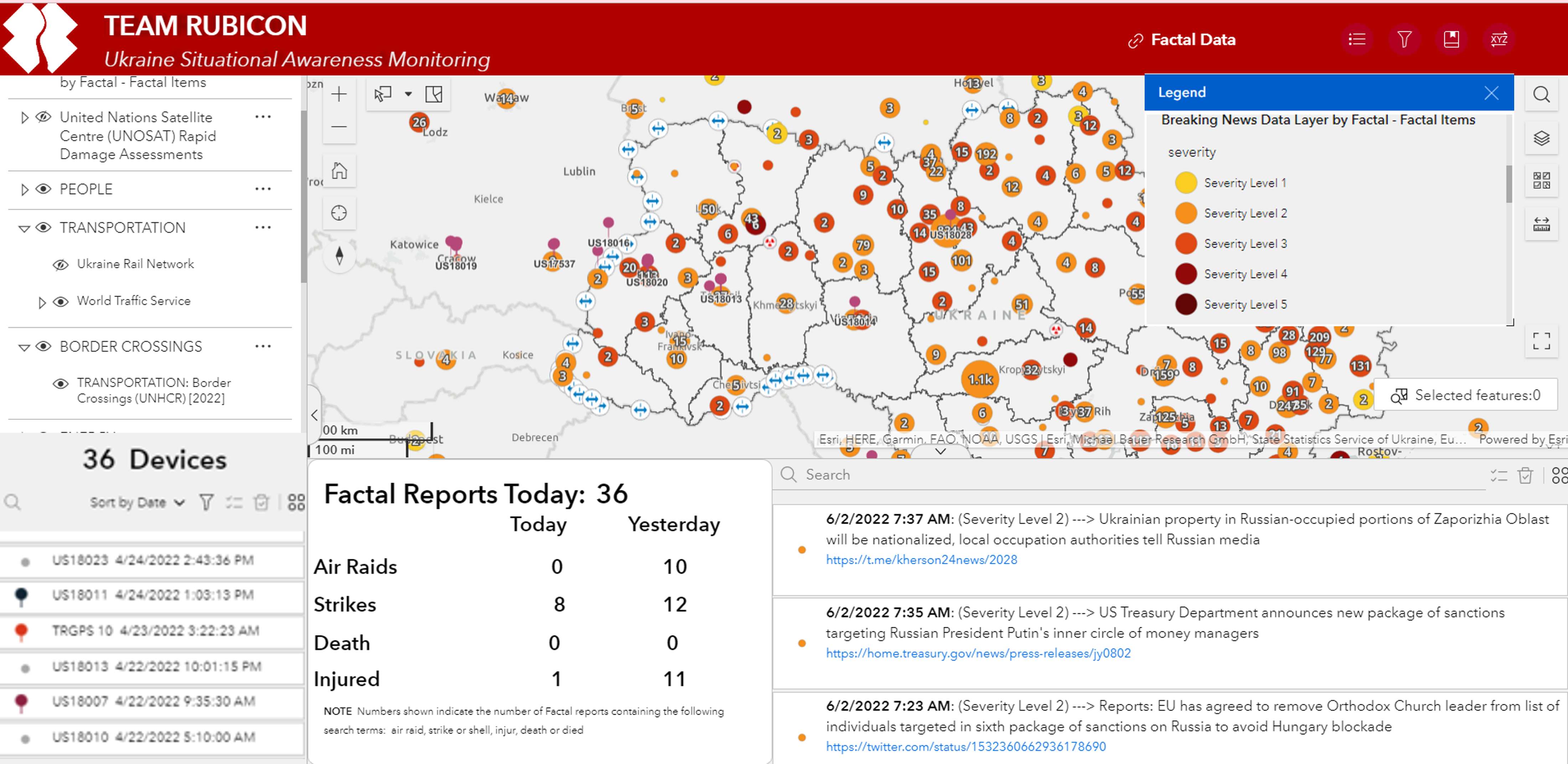
But, it was newer technological solutions that turned essential. Specifically, the ability to see, in near real-time, social media and news of events happening in the world, including reports of air strikes in neighborhoods and oblasts—or provinces—across Ukraine.
To gather such actionable info, Greyshirts turned to Factal, the news organization that combines the ability to scrape social media with AI technology and a newsroom staffed by journalists.
By monitoring different social media sources and other signals, Factal provides, in very close to real-time, knowledge of what’s going on in the world. “They’re really useful for things relating to natural disasters, and as we learned for the effort in Ukraine, keeping up with the real-time threat, whether it was monitoring air raid sirens and where they were going off or tracking actual strikes and where injuries and deaths were getting reported,” says Jessica Hulsey, a Greyshirt who served as part of Team Rubicon’s situation unit in Ukraine.
To make that info more actionable, the team integrated Factal reporting with Garmin device locations for the team on the ground, oblast boundaries, data on the movements of internally displaced stations, and more into map layers in Esri. The resulting dashboard allowed remote teams to assess security threats and risks to teams on the ground, analyze data by severity and by oblast, and perform trend analysis over time of key threat indicators.
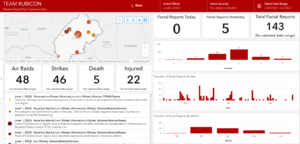
“We wanted to understand what kinds of facilities they [the Russians] were attacking,” says Hulsey. “Were they attacking train stations and the hospitals? And then at what frequency and at what time of day?”
Factal, when integrated with maps and location devices in Esri, made all that possible. It also allowed them to decide where to place medical providers and where to move within the country.
Such information was critical to Team Rubicon for planning medical missions and moving volunteers around, safely.
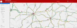
Take, for example, the moment the area around the train station was attacked in Lviv.
“When the train station was hit, we were able to produce a map, show how that was connected to the eastern part of Ukraine, and what it was going to then do—for at least a period of time—to internally displaced persons,” says Hulsey.
Tracking IDPs via Factal and other actionable info also allowed Team Rubicon to support ambulance logistics for transportation of patients from the Lviv train station to Rzeszow, Poland.
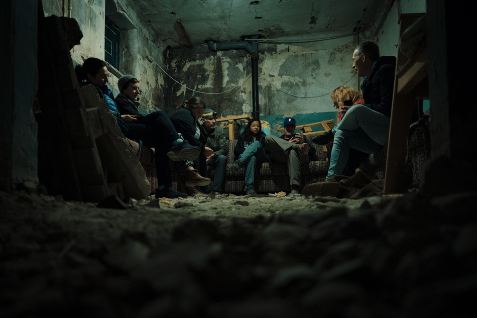
Eventually, all the intel gathered also helped Team Rubicon move outside of Lviv to serve areas farther east. “They really wanted to be able to see, oblast-by-oblast, or state-by-state, for comparison of what the threat looked like. And that resulted in the final evolution of our [Esri] dashboard, says Hulsey. The team was able to look at reports from news and social media, via Factal, to understand and assess the threat level in Ivano-Frankivsk and nearby states—analyses they had never really had a good way to do before.
With that information, the medical teams decided to go to Ivano-Frankivsk to train local medical providers in dealing with war trauma, casualty care, bleeding control, field blood transfusions, and more. Soon, the remote team was watching, on the dashboard, as the Garmin devices began to move out from Lviv.
Tapping social media in the disaster zone
In the end, 73 greyshirts provided medical care for more than 535 patients and provided training to more than 2,780 people in eight different courses in Ukraine. Using Factal and complex Esri dashboards likely won’t end with Team Rubicon’s response in Ukraine. As disaster season begins, especially with hurricane season in the southern U.S. on the horizon, Team Rubicon expects to lean on it all the more heavily.
“I think that’s going to be huge,” says Hulsey of integrating social media intel into disaster response domestically. Knowing where power is out in specific blocks within a neighborhood; that flooding is happening on specific cross streets, and pinning it all to a map could be a game-changer that will allow Team Rubicon to effectively figure out who is underwater, who’s going to need the most immediate aid, and where, precisely, Greyshirts should go to deliver it all.
What is Factal?
Factal alerts companies to global incidents that pose an immediate risk to their people or business operations. We provide trusted verification, precise incident mapping and a collaboration platform for corporate security, travel safety and emergency management teams. As part of our mission, more than 180 humanitarian relief NGOs access Factal for free – including Team Rubicon.
Experience a free trial or watch an introductory demo video at Factal.com.